
Night Lights Data - Introduction to Remote Sensing of the Earth at Night
The discovery of commercial lighting by Thomas Edison in 1879 revolutionised humanity by allowing days to be extended into night with a simple switch. Since then, it has resulted in the proliferation of simpler and cheaper light sources.
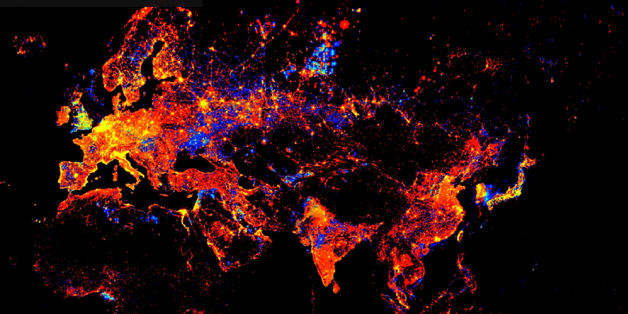
Changes in light intensity across from 1991 till 2012 using DMSP (Source: Google Earth Engine)
The image above shows the changes in light intensity from 1991 to 2012. Spots that are coloured the brightest shows the greatest increase in lighting. This situation while beneficial has created a new problem commonly referred to as ALAN (Artificial Lighting At Night).
So, what’s the issue with Lights?

Birds found in Philadelphia (Source: BBC)
Excessive lighting may sound seemingly innocuous especially when related to pollution. However increasing academic research and media publications indicate that ALAN has harmful effects on the surrounding environment.
Two commonly cited examples focus on the effects placed on the ecosystem and the economic effects of it. The image captured was featured in a BBC article titled ‘The argument for switching off lights at night’, which highlights the severity of ALAN on wildlife.
What can we do ?
Monitoring light pollution across cities and various geographical features such as National Parks make it challenging for human operators to do so. Remote Sensing bridges this gap by providing a snap shot over large regions. These images are sent back to Earth quickly making it convenient and insightful for governments to act on.

Source: Google Earth Engine — COPERNICUS/S2

Image courtesy of NASA
The images above shows Remote Sensing images of the UK, during the day and at night, compared to the Google maps image.

Furthermore, time lapse over time spans could be produced for analysis to be performed. The video below indicates a time series of clouds passing by Dubai’s coast.
How do images of the earth at night help us?

Comparison of nighttime light products from the Defense Meteorological Satellite Program (DMSP) Operational Linescan System (OLS) sensor and the joint NASA/NOAA Suomi National Polar-orbiting Partnership (Suomi NPP) Visible Infrared Imaging Radiometer Suite (VIIRS) instrument. Images were acquired November 2012 over Delhi, India. NASA Earth Observatory image.
Viewing night-time lights provides a unique perspective of the planet, and from there we can take a number of highly valuable insights.
Night-time light observations from remote sensing, otherwise known as ‘nightlights data’, provides us with a timely and spatially explicit measure of human activities. This dataset enables a range of applications including tracking urbanization and socioeconomic dynamics, evaluating armed conflicts and disasters, investigating fisheries, assessing greenhouse gas emissions and energy use, and analyzing light pollution and health effects to name a few (Zhao et al., 2019).
In February 2021, Alba Orbital hosted the Night lights workshop, the first international conference dedicated to exploring the applications of night time satellite imagery. Presentations came from a range of academics in the night time remote sensing community. It was at this event, where Alba Orbital shared their plans to develop a pico-satellite constellation dedicated to providing the highest resolution dataset of the earth at night.
Satellites — Big and not so Big
Satellites are traditionally understood to be huge in size. The chart below highlights the relative size and weight of Satellites.

Source: Canadian Space Agency
Pico Satellites
A Pico Satellite has elementary dimensions of 5 cm x 5 cm x 5cm. Just imagine a Rubik’s cube , but packed internally with cutting edge hardware and capabilities.
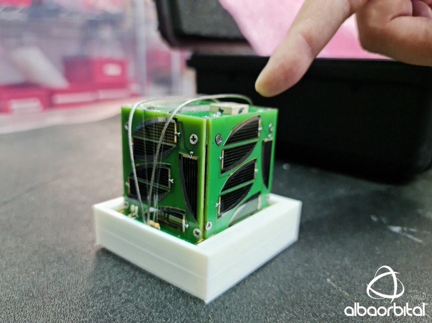
1P pico-satellite (known as a ‘PocketQube’) developed by MyRadar (USA)
It may come as a surprise that it is possible for Satellites to be light weight and cost effective. Furthermore, the compact size leaves no traces of debris in Space once the mission lifetime is over.
Unicorn-2 and future developments
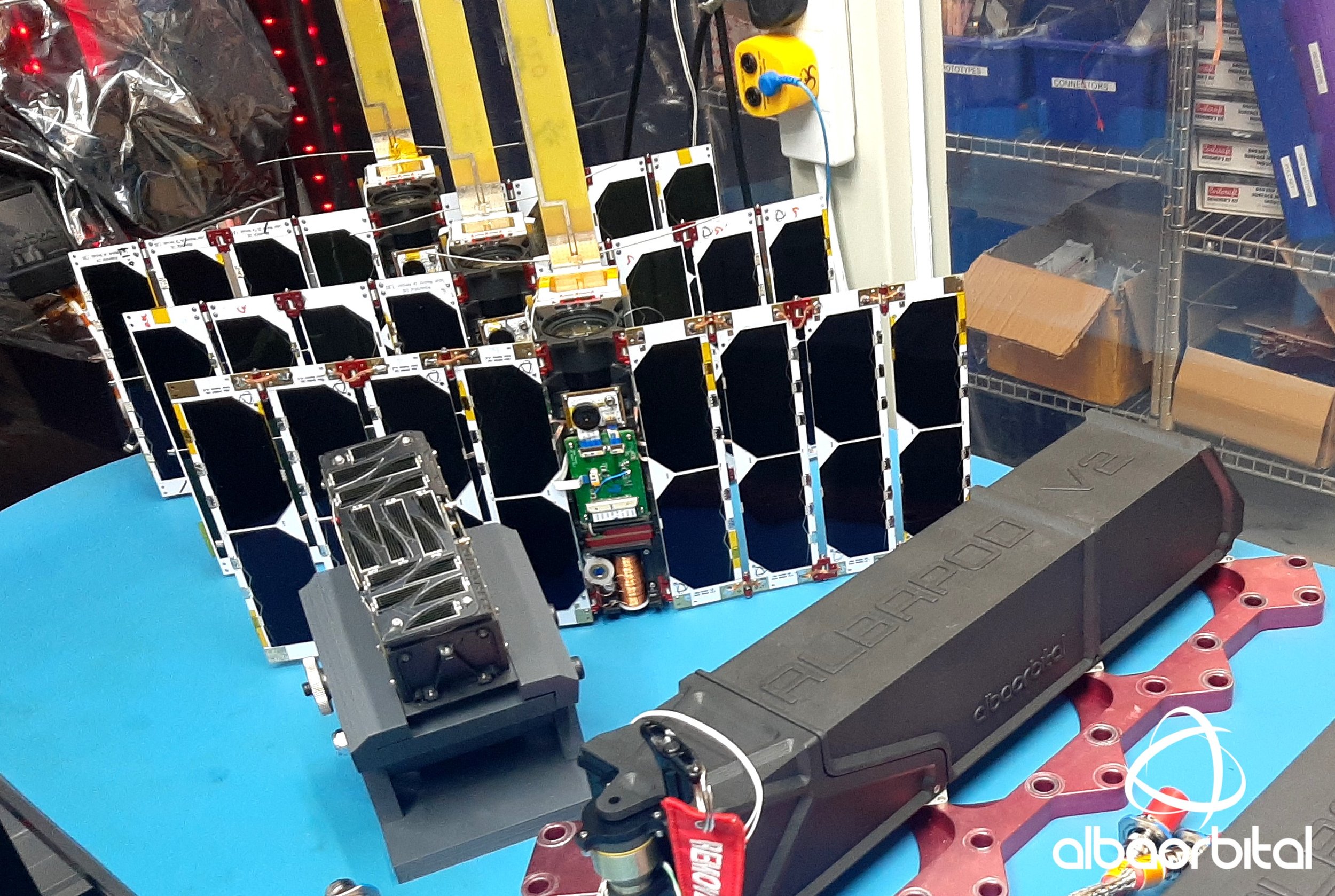
Night-time remote sensing ‘Unicorn-2’ pico-satellites prepped for SpaceX launch in Q1 2022.

Artist’s impression of the Unicorn-2 ‘night-lights’ constellation in-orbit.
Alba Orbital will be using its demonstrated Unicorn 2 for launch in 2022 January to introduce the world’s first Night Time imaging pico-satellite constellation. This would be followed by additional launches in the next 2 years to create a one stop constellation dedicated to imaging Earth at Night.
Word on Space Debris……………….
There are obvious concerns about Space debris in orbit after the mission lifetime is over. Pico-satellites have an average mission lifespan of anytime between 1–3 years. They deorbit and burn up within the Earth’s atmosphere leaving no remains behind. Additionally, they are small enough to remain invisible in the sky. So future developments for Pico-satellite constellations would pose no issues.